The following story presents a selection of works from the book Meerreeng-an Here is My Country: The Story of Aboriginal Victoria Told Through Art
Meerreeng-an Here is My Country: The Story of Aboriginal Victoria Told Through Art tells the story of the Aboriginal people of Victoria through our artworks and our voices.
Our story has no beginning and no end. Meerreeng-an Here is My Country follows a cultural, circular story cycle with themes flowing from one to the other, reflecting our belief in all things being connected and related.
Our voices tell our story. Artists describe their own artworks, and stories and quotes from Elders and other community members provide cultural and historical context. In these ways Meerreeng-an Here Is My Country is cultural both in its content and in the way our story is told.
The past policies and practices of European colonisers created an historic veil of invisibility for Aboriginal communities and culture in Victoria, yet our culture and our spirit live on. Meerreeng-an Here Is My Country lifts this veil, revealing our living cultural knowledge and practices and strengthening our identity.
The story cycle of Meerreeng-an Here Is My Country is presented in nine themes.
We enter the story cycle by focusing on the core cultural concepts of Creation, Country, culture, knowledge and family in the themes 'Here Is My Country' and 'Laws for Living'.
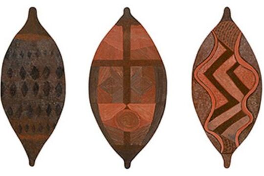
The cycle continues through ceremony, music, dance, cloaks, clothing and jewellery in 'Remember Those Ceremonies' and 'Wrap Culture Around You'. Land management, foods, fishing, hunting, weapons and tools follow in 'The Earth is Kind' and 'A Strong Arm and A Good Eye'.
Invasion, conflict and resilience are explored in 'Our Hearts Are Breaking'. The last two themes, 'Our Past Is Our Strength' and 'My Spirit Belongs Here', complete the cycle, reconnecting and returning the reader to the entry point by focusing on culture, identity, Country and kin.
Visit the Koorie Heritage Trust website for more information on Meerreeng-an Here Is My Country